Long term weather forecast for power trading: Webinar from Refinitiv 17 November 2022
Refiinitiv Eikon presented a very interesting webinar last Thursday, with content provided by their European Power team. Despite being a lifelong fan of the Reuters terminal, now in its new incarnation as Refiniitiv Xenith, I wasn’t aware that they were tracking and forecasting weather patterns. Gabrielle Martinelli, manager of European Power, steered the meeting, with content provided by analyst Sebastian Sund and senior meteorologist Georg Mueller.
At the moment they are focusing on Europe and the Nordics, aiming to help the power industry in this part of the world. You might say, I wonder why?
Mainly using data collected by the European Centre for Medium-Range Weather Forecasts, both the centre and Xenith collate and forecast weather patterns from 10 to 46 days ahead. ECMWF’s operational forecasts aim to show how the weather is most likely to evolve. To do this, the Centre produces an ensemble of predictions – where these tend to maintain their correlations. Unfortunately Refinitiv only have four and a half years’ worth of  information of the ensemble regression trees on which they are working.
Seasonal forecasts, up to 7 months ahead, use data from the US Global Forecast System. ‘Average’ temperatures are based on data from 1991 to 2020, and also take into account temperature, wind, solar and hydro. Both research/forecasting centres collate data from weather stations, where the higher the density of these the greater the accuracy and, obviously, the better the granularity and the lower the effect of bias.
Note that the World Meteorological Organisation takes potential climate change into account with its long term forecasts.
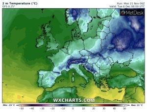
For this winter in the Northern hemisphere they feel October’s thunderstorms have been extreme and are not expected to last. The Nordics and Eastern Europe should be slightly warmer than usual while the very far East of
Europe is expected colder than average. Weather in Western Europe is expected to become more unsettled in February 2023.
Arctic Amplification, where warming is stronger around the Circle, should lead to further demise of sea ice. Sea Surface Temperature in the Pacific Ocean should have little effect in 2023 as El Niño is in a negative phase (more commonly known as La Niña).
https://www.ecmwf.int/en/forecasts/charts
Tags: forecast, time horizon, Weather
The views and opinions expressed on the STA’s blog do not necessarily represent those of the Society of Technical Analysts (the “STA”), or of any officer, director or member of the STA. The STA makes no representations as to the accuracy, completeness, or reliability of any information on the blog or found by following any link on blog, and none of the STA, STA Administrative Services or any current or past executive board members are liable for any errors, omissions, or delays in this information or any losses, injuries, or damages arising from its display or use. None of the information on the STA’s blog constitutes investment advice.
Latest Posts
- Living in a land of large numbers: How to get a grip July 24, 2024
- Debate with ACI UK, The Broker Club & The Commodities Trading Club: Forecasts for the second half – plus marks for first half July 10, 2024
- Retail traders embrace volatility: Zero-day options and penny stocks on today’s menu June 24, 2024
- STA members and their guests get a dose of hypnotherapy June 12, 2024
- ‘And it’s a goal! Again’ Rectangles, corsets and straightjackets May 28, 2024


Latest Comments